


Georadar in geophysic investigation
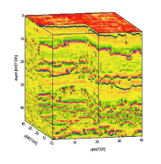
Georadar is a method developed by NASA. It registers the changes in electrical characteristics / conductivity and permittivity / environment that are directly dependent on the type of soil and rocks and the physical and chemical properties, by simply using high-frequency electromagnetic waves / 10 MHz-2000 MHz /. Georadar system sends through its antenna device pulsed electromagnetic signal to the Earth's matter into it and register under the reflected signal and the time for its return to the receiver. In the distribution of radiated electromagnetic waves in depth in environments with different dielectric constants, the boundary between them seems to be clear on the monitor and is it called radargram. Often more immediate radargrama possible interpretation of the layers, linear and point reflectors. Standard, however, the primary radargrami further processed by software, thus achieving maximum compliance with their reality and their subsequent objective interpretation by the company experts.
Georadar is the ideal solution for:
- Determining the location of objects and the presence of communications under ground / water pipelines, gas pipelines, oil pipelines, power cables / and also leaks in pipes themselves;
- Localization of cracks, subsidence, cavities and other defects in the base and paving of roads, runways, railways lines;
- Localization of cracks, subsidence, cavities and other defects in the tunnels and tunnel construction;
- Localization of thinning, distortion, cracks, voids and other defects in bridges;
- Location of underground tombs and architectural sites;
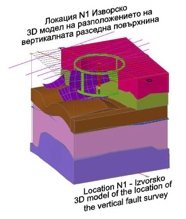
- Localization of landslide surfaces, subsidence, faults, etc. hazards in the construction design of works;
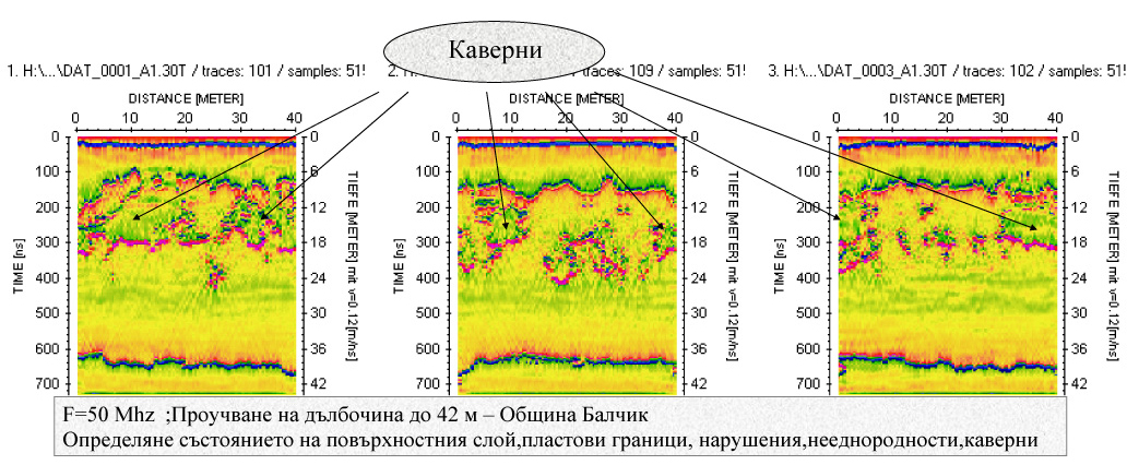
- Localization of caverns, caves and other karst formations, causing subsidence of the ground;
- Determination of the lithological composition and power of the layers of studied land;
- Determining the level of groundwater;
- Determination of the thickness of sediments in lakes and reservoirs and mapping of the bottom;
- Identification of contaminated earth strata;
The company has a complete set of equipment georadarno Swedish company Mala GeoScience AB, which enables us to decide that a wide range of practical tasks for research in depth from 0.2 to 3 meters to 30-40 meters:
- Antenna 1,6 MHz - for detailed studies in depth of 0.5 m, depending on the specific properties of the medium;
- Antenna 800 MHz - for detailed studies in depth from 2.5 to 3 meters, depending on the specific properties of the medium;
- Antenna 250 MHz - for detailed studies in depth of 8-10 m, depending on the specific properties of the medium;
- Antenna 100 MHz - for detailed studies in depth to 12-15 m, depending on the specific properties of the medium;
- Antenna 50 MHz RTA - for detailed studies in depth of 30-40 m, depending on the specific properties of the medium;
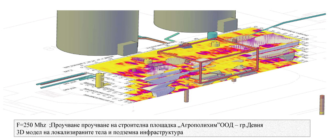
- "Georadar investigation and engineering geological study of the subject 'New system for ammonium nitrate, in the territory of Agropolichim Ltd.
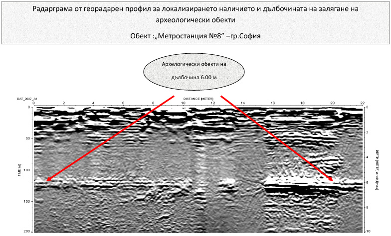
- "Georadar investigation and determining the location of archaeological sites at the construction site of Metro № 8" assignment of "Metro Alianz" DZZD;
- "Georadar survey to locate and establish the depth of the existing two cracks on the North Slope of SC-1 against the switchyard control room of the Kozloduy.
- "Georadar study to identify the possible presence of caverns, disturbed areas and weaker sections in the fundamentals of wind farms in the town of Kavarna and villages Trigortsi and Sokolov, Balchik region.
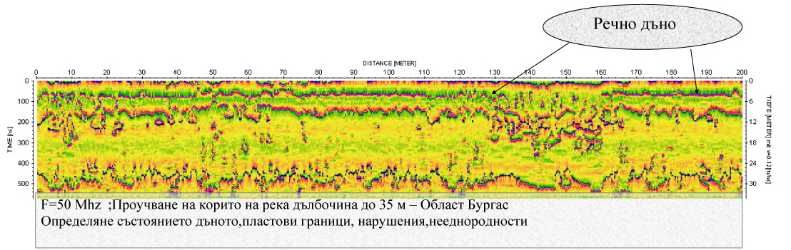
- "Georadar study to detect the presence and mode of occurrence of various geological strata below the water surface of the object" Most of the Maritsa River - Svilengrad "
 |
|
 |
|
 |
|
 |
|
 |
 |
